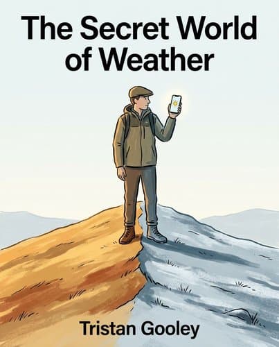
54110452_the-secret-world-of-weather
by Tristan Gooley
Nature broadcasts precise weather forecasts through cloud shapes, spider behavior, and the angle of trees—you've just forgotten how to read them.
In Brief
Nature broadcasts precise weather forecasts through cloud shapes, spider behavior, and the angle of trees—you've just forgotten how to read them. Tristan Gooley restores that lost sensory literacy, turning every landscape into a reliable forecast you can trust more than your phone.
Key Ideas
Cumulus growth signals evening storm arrival
Watch cumulus clouds from mid-afternoon onward: if they keep growing as the sun weakens, the air is genuinely unstable and bad weather is coming that evening; if they shrink and dissolve at the same rate the sun fades, the night will be fair.
Leftward cirrus movement forecasts rain within hours
Stand back to the lower wind. If high cirrus clouds move left-to-right across your line of sight, a low-pressure system and frontal rain are approaching — the basis of a reliable 12-to-24-hour forecast using nothing but your eyes.
Jet-stream ropes predict intensifying winds soon
Very long parallel lines of cirrus ('jet-stream ropes') covering more than half the sky signal increasing winds within 12 hours and a warm front within 24 — one of the earliest and longest-range signs available without instruments.
Dew patterns reveal fog formation potential
Dew always precedes radiation fog — the two share the same formation conditions (clear sky, calm air, moist ground). If there has been no dew, radiation fog cannot form. If you encounter fog and there has been no recent rain, look for a large body of water nearby: it mapped it.
Valleys trap cold air creating frost
Cold air is denser than warm and drains downhill, pooling in valleys and hollows. Frost and fog always hit valley floors first and hardest; hilltops are often several degrees warmer on clear mornings — plan routes and campsites accordingly.
Sudden cold gust indicates hidden storms
A sudden cold gust with no obvious source (no sea breeze, no slope wind to explain it) is a storm alarm: a cumulonimbus growing out of your sightline may be pulling air upward from below, reversing the surface wind toward itself.
Backing wind signals deteriorating weather conditions
When wind direction backs (shifts counterclockwise), foul weather is approaching; when it veers (shifts clockwise), conditions are improving. This single rule — derived from the Coriolis circulation around pressure systems — underlies most of the book's wind-based forecasting.
Who Should Read This
Science-curious readers interested in Ecology and Skill Acquisition who want to go beyond the headlines.
The Secret World of Weather
By Tristan Gooley
9 min read
Why does it matter? Because the weather you actually experience is not in any forecast.
Your weather app says sunny all day. Then you step between two buildings and the cold hits you sideways. Cross the street: gone. That gap between what the forecast told you and what your skin just felt is not a glitch. It is the subject of this book. Professional forecasts describe the atmosphere averaged across miles and sampled above the treetops — which is genuinely useful, and genuinely incomplete. The weather you actually experience is shaped by the valley you are standing in, the tree at your shoulder, the dark patch of soil ten paces ahead. Tristan Gooley's claim is that the landscape has always been broadcasting this information, in signs that are plain once you know where to look. You have been walking through a forecast all your life.
The Better Weather Forecasting Gets, the Less It Tells You About the Weather You Live In
Professional weather forecasting is one of the great success stories of applied science — and it has almost nothing to do with the weather you actually live in.
That sounds unfair. In the past century, forecasters gained better data, faster computers, and near-instant global communication. A storm that killed forty-four fishermen off the coast of Ireland in the 1930s was correctly predicted, but the warning arrived too late by radio. Today those warnings travel instantly. Five-day forecasts that would have seemed miraculous in 1955 are now routine. Professional forecasting solved a particular problem: how to predict large atmospheric systems over wide regions. The weather you inhabit — the air between your shoulder blades, the chill at the bottom of a field — is a different problem, and no app has solved it.
Here is why. In the Swiss Jura mountains, a ridge barely fifty centimeters wide separates two distinct ecosystems. On the south slope: downy oaks, trees that need warmth. On the north: Alpine pennycress, a plant adapted to near-subalpine conditions. To cross that ridge on foot takes one step. Climatically, that step is equivalent to traveling 625 miles toward the poles or ascending 3,000 feet. The landscape has created weather so different on either side that entirely different species evolved to fill each niche. No regional forecast can see this. No forecast can tell you what the air will feel like on the north face of that ridge.
The weather the land produces at the scale you actually move through is the part no forecast can reach. Your app tells you it will be partly cloudy. The ridge already knows it will be cold.
The Sky Has Seven Rules — and You Can Read Tomorrow's Weather Using All of Them
One morning in West Sussex, Tristan Gooley walked into a field and looked up. The sky seemed fine — mostly clear — but cirrus and cirrostratus crowded the highest levels, moving in different directions. He knew rain would fall before he went to bed. That afternoon he led a group of walkers for hours. Nobody mentioned the clouds. By the end of the walk, everyone was talking about the sky. They felt the first drops as they stopped.
The sky had been communicating the whole time. Gooley had read it. Most people around him didn't know there was anything to read.
The language starts with seven patterns that hold everywhere, regardless of cloud type. Lowering clouds signal worsening weather. The key is the downward trend, not the current height. Multiple cloud types visible at once guarantee atmospheric instability at some levels. Growing small clouds mean deterioration; shrinking clouds mean improvement. Clouds much taller than wide signal unstable air. Spiky tops warn of unsettled weather; smooth rounded tops don't. A rough base on a dark cloud means rain is close; a flat base means it isn't. And low clouds are short-range instruments: minutes of warning, not hours.
To use those patterns, you need to recognize three cloud families: cirrus (high and wispy, the earliest long-range indicators), stratus (flat grey sheets stretched across the sky, a sign of constancy rather than violence), and cumulus (heaped, bubbling upward, marking local instability from warm air rising below).
The most useful test runs every clear afternoon. Watch cumulus clouds from mid-afternoon onward. The sun powers thermals (columns of warm air rising from heated ground), and those thermals build cumulus. As the sun weakens, the thermals weaken. The question is whether the clouds weaken with them. If cumulus dissolve by late afternoon, losing their edges and breaking apart, their only engine was solar heat, the air is stable, and the evening will be fine. But if they keep growing as the sun drops, they are no longer being powered from below. Condensing moisture releases heat, driving more lifting, causing more condensation: the cloud is feeding itself. That is a genuinely unstable atmosphere, and bad weather is coming.
Every clear afternoon you have spent outdoors, this test was running. The clouds were answering "stable" or "unstable." You just didn't know the question.
Three Mechanisms Explain Every Weather Sign You Will Ever See
Imagine learning a language by memorizing thousands of phrases but no grammar. You'd get by, but every new sentence would require a new memory. That's how weather signs work for most people — red sky at night, swallows flying low, mist in the valley. Each one a separate rule, disconnected from every other.
The grammar behind all of them is three mechanisms: radiation, which travels as waves across space and explains why dark surfaces warm faster than light ones; convection, warm air rising through cooler air; and latent heat, the energy released when vapor condenses into cloud. Every weather sign traces back to one or more of them.
The thermal clock makes this concrete. Radiation warms the ground each morning, and the air above the warmest patches rises in columns called thermals. These columns strengthen as the sun climbs and heats more intensely. Different travelers need different lift to get airborne. Seeds go first, feathery species like ragwort catching currents too faint for anything else. Dragonflies follow. Then small birds of prey, circling over dark patches of woodland where the ground radiates most heat. Last come the large raptors, which need a powerful current to carry their weight. Watch any patch of open sky through a single morning and you'll see the sequence unfold — a biological hierarchy that maps the intensifying heat of the earth beneath it.
The hawk circling at noon isn't a separate fact to file away. It's radiation heating dark soil, creating convection, lifting the heaviest fliers last. The mechanism explains the sign. And once you see that connection, every other weather sign becomes a question you already know how to answer.
Wind Direction Is the Single Most Useful Number in Weather — and Almost Nobody Uses It
That morning, before he met Hannah Thompson, Gooley had noticed the wind back nearly ninety degrees. Counterclockwise. That's the signal that a low-pressure system is advancing; foul weather follows. He already knew rain was coming before a cloud had appeared.
Thompson is a National Trust ranger walking with him through a reforesting project in West Sussex called the Rise of Northwood — over ten thousand young trees, each staked against the wind. Most are doing well. In one zone, without any obvious cause, they've all died. The soil is no different. The drainage is no different. Then a burst of cold air hits the back of Gooley's neck, and the answer becomes physical before it's intellectual: they're standing at the midpoint between two older woods. The same main wind that arrived with the advancing low dropped into that exposed gap, stripped the saplings of warmth, and vaulted up over the trees. Those young plants were placed exactly in its path.
One detail most people would miss: a wind shadow exists in front of a tree barrier as well as behind it. Walk toward either wood from that midpoint and the wind slows — on both the windward and downwind sides. The most exposed location between two woods is the middle.
Wind direction encodes the movement of entire pressure systems, carrying tomorrow's weather with it. Speed tells you how hard the wind is blowing now. Direction tells you what arrives next. Most people check speed. The useful number was always direction.
The Absence of Dew on One Car Convicted a Murderer
One August morning in 1986, Pennsylvania police arrived at a house to find Betty Wolsieffer beaten to death. Her husband Glen had a story: an intruder, a ladder, a first-floor window. Officers looked at the roof the intruder was supposed to have crossed. It was coated in dew. There were no footprints in it.
Then they looked at the driveway. Betty's car was covered in dew. Glen's was dry.
A forensic meteorologist explained what the cars had recorded. Dew forms when a surface loses heat to the cold night air faster than it is replenished from below. Betty's car had sat still all night; its metal cooled steadily until moisture condensed across every panel. Glen's car had no dew because Glen had driven it after dew had already formed — engine heat and the rush of air had dried the surface clean. His claim to have been home since 2:30 a.m. collapsed. He was convicted of murder. The documentary was called Dew Process.
What the meteorologist understood is that dew doesn't fall from the sky — it maps heat. The same logic explains why dew soaks a lawn but leaves adjacent soil dry. Grass blades are poor conductors: they radiate surface warmth outward but draw nothing up from the earth to replace it. Soil does the opposite — it conducts heat continuously from underground, staying just warm enough to keep condensation from forming.
Every Living Thing Around You Is Already Running a More Precise Weather Forecast Than Your Phone
Does any of it actually work? The lore about animals predicting weather (swallows flying low, cows lying down, spiders spinning shorter webs) gets passed down not because anyone confirmed it but because it sounds right. Most of it isn't right. Cows lie down to chew their cud. Dogs eat grass for reasons that have nothing to do with rain.
But spider webs are different. Wind-tunnel experiments confirm that spiders build smaller webs when the wind is stronger. The old lore says shorter webs mean rain is coming. The connection runs through something you already know: wind strengthens before a pressure front arrives. The chain is real. A spider web's architecture responds to wind speed continuously, recalibrating with every hour — no weather app updates that often. The lore worked because it was always a mechanism: spiders measuring wind, wind announcing what was coming. Generations of outdoor observation accidentally captured something true.
That's the shift. Animals, trees, and lichens aren't omens; they're instruments, responding continuously to the same physical variables this book has described. Moss grows higher on tree trunks in humid spots because epiphytes pull moisture directly from air. Pine cones open in dry weather and close when humidity rises, a passive mechanical response that continues even after the cone falls. Neither is predicting. Both are measuring.
Gooley uses birds the same way, not as omens but as a nudge. From his cabin window, a spruce branch is a regular perch. Because prevailing winds carved the tree's shape from the southwest, birds almost always sit facing that direction. When he notices them facing the wrong way, he scans the sky and finds cirrus that has been building unnoticed for over an hour. The birds hadn't predicted weather. They had simply noticed the wind shift before he did — and jolted him back to the sky.
The Storm Announces Itself Hours Early — but Only If You Know What to Look For
In 2007, Gooley was offshore near the Isle of Wight, testing a self-steering wind vane on a small sailboat, a mechanical device that holds a constant angle to the wind using nothing but the flow of water beneath the hull and air across the sails. He was absorbed in ropes and pulleys when the boat swung hard and completed a full 180-degree turn. He checked the vane: working perfectly. He was still sailing with the wind on the same side. Everything was functioning exactly as designed. He was just going in the opposite direction.
The wind had reversed.
Only then did he look up. A storm cloud had been building unnoticed while he focused on the equipment. A growing cumulonimbus pulls air violently upward, and that suction draws surface wind in from all directions. The wind he had been sailing wasn't blowing anywhere; it was being inhaled. He reefed the sails and made for shore.
The sign was real. He just read it one beat late.
The sequence that gives you hours of warning runs like this. A smooth cap cloud above a growing cumulus (called a pileus) signals updrafts so powerful they've shoved the air above the cloud upward until it condenses. The storm is forming. Watch the top: rounded and cauliflower-shaped means liquid water, still rising. When the top goes wispy and soft, with the cotton-candy texture of high cirrus, ice crystals are forming and the cloud is becoming a cumulonimbus. At its peak, the anvil spreads asymmetrically, its stretched side pointing the direction of travel. Later, pendulous bulges appear on the underside — called mamma — meaning downdrafts have taken over. The storm is past its worst.
That sequence unfolds across roughly ninety minutes. You can watch each step from a safe distance, if you know what to look for.
That is the shift — not a library of signs to memorize, but a different relationship to the air you move through. The sky has been announcing itself your entire life. You now have some idea what it's saying.
You Have Always Been Walking Through a Forecast
The first walk you take after closing this book will feel strange — not because the landscape has changed, but because you have, without going anywhere. The cirrus has always been there. The dew has been writing its thermal record across every lawn you've crossed at dawn. The cumulus have been answering "stable" or "unstable" every clear afternoon for your entire life. None of this was invented by Gooley; it was assembled by people who had no alternative to paying attention — sailors who read swells, desert travelers who felt the air shift against their skin. It was never lost. It simply waited for you to return. What has changed is the looking. And looking, when it is genuinely sharp, does not leave you standing apart from what you see. It draws you into it.
Notable Quotes
“and it is different on two sides of a tree. This is a basic truth, yet if you suggest it to a professional meteorologist they will demur:”
“I have heard a version of this reply many times, and I always agree, saying,”
“small spiders which swarm in the fields in fine weather in autumn, and have a power of shooting out webs from their tails so as to render themselves buoyant and lighter than air.”
Frequently Asked Questions
- What is 'The Secret World of Weather' about?
- "The Secret World of Weather" (2021) teaches readers to forecast weather through direct observation of clouds, wind, terrain, and plants — no instruments required. Drawing on traditional natural navigation, it provides a practical system of signs and rules for making reliable short-range predictions from any landscape. Rather than relying on meteorological technology, Gooley's approach focuses on reading cloud growth, wind direction shifts, and cold air drainage patterns. The book equips outdoor enthusiasts, navigators, and weather-curious readers with observation techniques applicable anywhere, transforming how you interpret the sky and surrounding landscape for weather clues.
- How can you tell if bad weather is coming by watching clouds?
- Watch cumulus clouds from mid-afternoon onward to assess evening conditions. According to Gooley, "if they keep growing as the sun weakens, the air is genuinely unstable and bad weather is coming that evening; if they shrink and dissolve at the same rate the sun fades, the night will be fair." For longer-range forecasting, examine cirrus patterns: "Very long parallel lines of cirrus ('jet-stream ropes') covering more than half the sky signal increasing winds within 12 hours and a warm front within 24 — one of the earliest and longest-range signs available without instruments." These observations form the foundation of unaided weather prediction.
- What do wind direction changes reveal about approaching weather?
- Wind direction changes follow a fundamental rule that underlies most of the book's forecasting: "when wind direction backs (shifts counterclockwise), foul weather is approaching; when it veers (shifts clockwise), conditions are improving." This principle derives from Coriolis circulation around pressure systems. To apply this effectively, "Stand back to the lower wind. If high cirrus clouds move left-to-right across your line of sight, a low-pressure system and frontal rain are approaching — the basis of a reliable 12-to-24-hour forecast using nothing but your eyes." Monitoring wind direction alongside cloud movement provides practical, instrument-free forecasting for the next day.
- What signs indicate when radiation fog or frost will form?
- Dew presence is the key indicator for radiation fog formation: "Dew always precedes radiation fog — the two share the same formation conditions (clear sky, calm air, moist ground). If there has been no dew, radiation fog cannot form." Geographic location determines where conditions are most severe. "Cold air is denser than warm and drains downhill, pooling in valleys and hollows. Frost and fog always hit valley floors first and hardest; hilltops are often several degrees warmer on clear mornings." Understanding these patterns helps you plan routes and campsites to avoid the harshest conditions during clear nights when radiation cooling occurs.
Related Book Summaries


Read the full summary of 54110452_the-secret-world-of-weather on InShort